
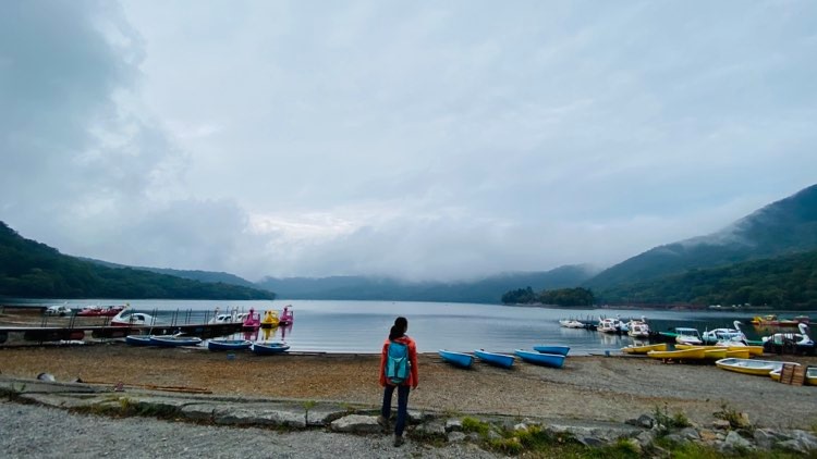
Mt. Akagi has multiple peaks. The tallest one is called Mt. Kurobi, and it’s quite easy to access from the parking lots around Lake Onuma.
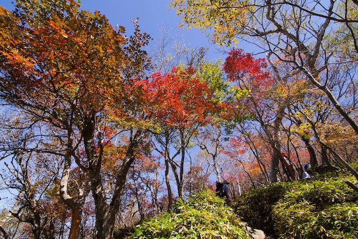
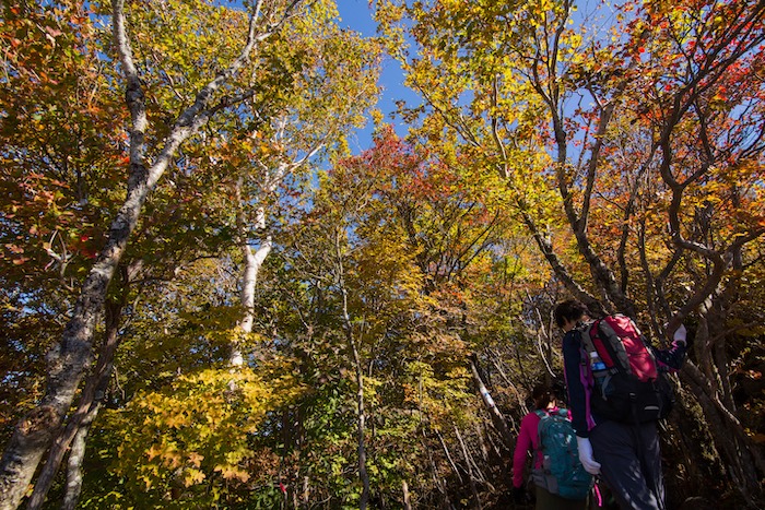
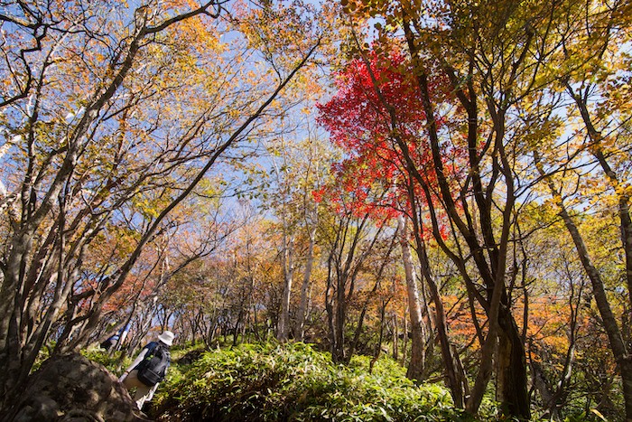
At 1827m, it’s much colder on this peak than it is on the ground, so the trees start turning colors very early in the autumn. The foliage is quite colorful right now, and will probably stay bright and beautiful for the next week or so. Which means this is the perfect time to try out the Mt. Kurobi - Mt. Komagatake Loop Trail!
---
Trail overview
Moving time: 3.5 - 4 hours
Level: Intermediate
Start point: Onoko Parking Lot https://goo.gl/maps/SCoypdhDLW4oZa3U8
1.Onoko Parking Lot → 15 mins →
2.Mt. Kurobi Trailhead → 1.5 hrs →
3.Mt Kurobi → 50 mins →
4.Mt. Komagatake → 50 mins →
5.Mt. Komagatake Trailhead → 5 mins →
back to 1. Onoko Parking Lot
---
Hiking tips:
- The Akagi summit area is usually about 10-15°C cooler than the ground (20-30° cooler in Fahrenheit), so it’s best to bring warm layers. The trailhead near Onoko Parking Lot is already 1,300 meters up, so plan for cooler temperatures right from the start of your hike.
- It is STRONGLY RECOMMENDED that you follow this loop trail in the suggested direction. The trail up to Mt. Kurobi from the road is steep and rocky--it’s comfortable to ascend, but it’s much harder to descend. People twist ankles trying to do down this trail all the time, and there are a few people every year who injure themselves badly and have to be airlifted out. Please use your best judgement.
---
Trail Details
1.Onoko Parking Lot https://goo.gl/maps/SCoypdhDLW4oZa3U8
Parking is free, and there are bathrooms if you need them! This lot can be crowded during fall foliage season, but don’t worry if it's full: there are several other lots along the same road.
For those without a car, this parking lot is also bus accessible! Take a bus from Maebashi Station to Akagi Hiroba Mae bus stop (https://goo.gl/maps/P3SfGDJtjNV9Ue8JA)--the bus stop is directly across the street from the parking lot.
To start your hike, turn left out of Onoko Parking Lot and walk north up the road. You’ll pass by Akagi Shrine, and then find the Mt. Kurobi trailhead on your right.
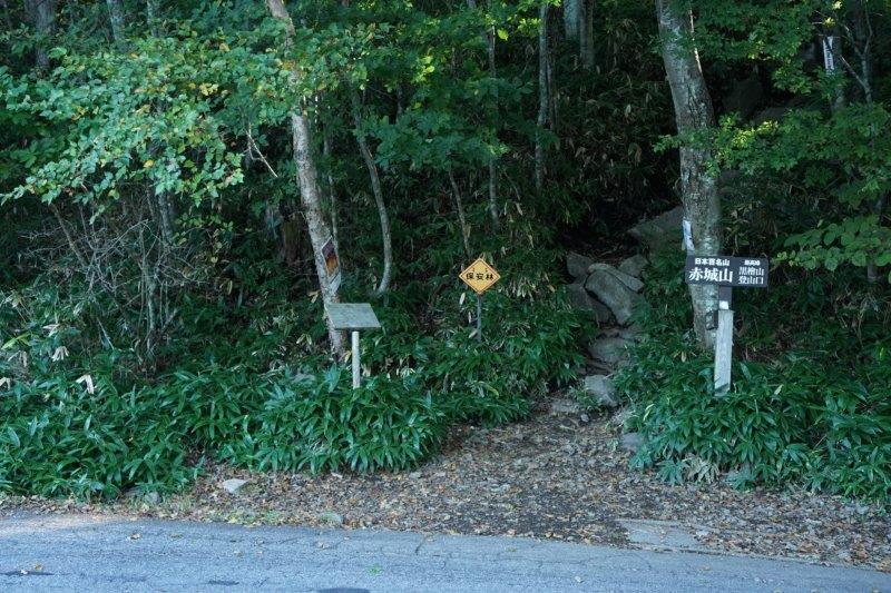
2.Mt. Kurobi Trailhead https://goo.gl/maps/cqGFs6WrRJfGyB8U7
There will be a wooden post to mark the start of the trail. It’s about an hour and a half hike up from here, and the trail is steep and rocky.
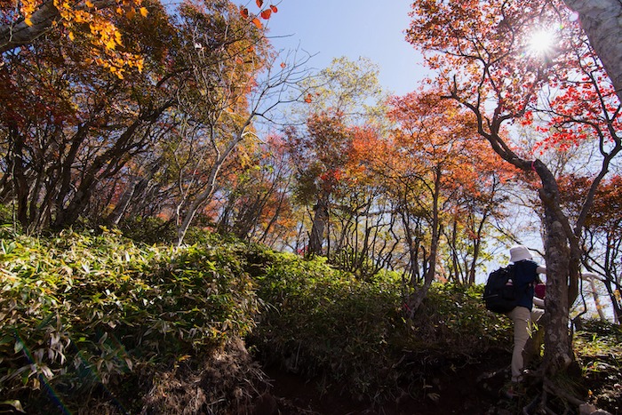
As you ascend, there will be several points where the right side of the trail offers great views of Lake Onuma.
Once you get most of the way up, the trail forks. Take the sharp left to continue to the top of Mt. Kurobi. (Ignore the sign for Komagatake for now--we’ll head there later.)
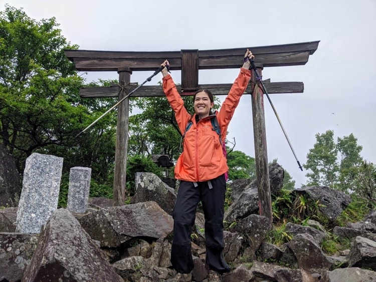
3.Mt Kurobi https://goo.gl/maps/9rZJ32nwkUyBqYgC8
There will be a sign to mark the true summit. Snap a picture to document your achievement, then continue down the trail---there’s more to see further along!
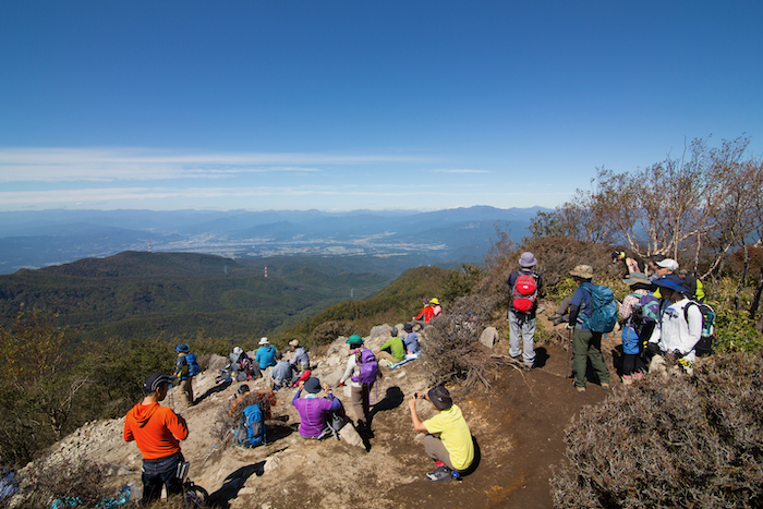
After another couple of minutes, you’ll get to the lookout point for some sweeping views of Numata and northern Gunma. This is a good spot for lunch. Once you’re ready to get moving again, turn around and head back the same way you came.
When you get back to the fork in the trail, turn left and follow signs for Mt. Komagatake.
Pass by Kurobi Shrine.
After that, the trail will go downhill for a bit, and then there’s a short climb.
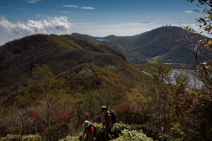
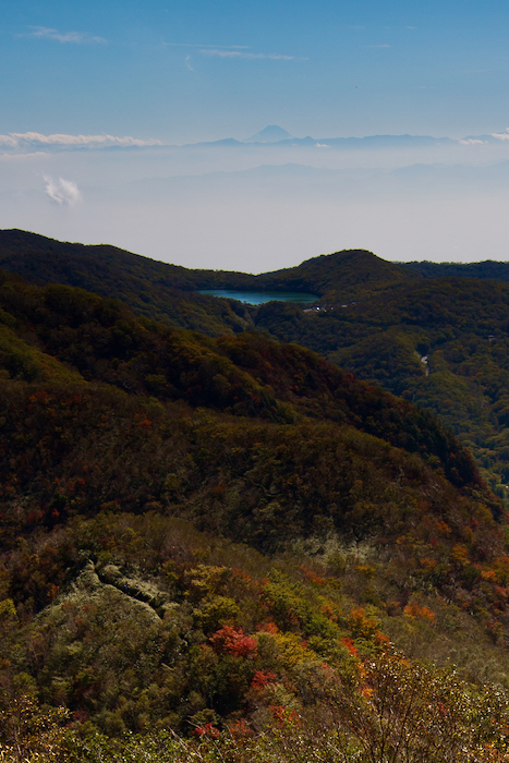
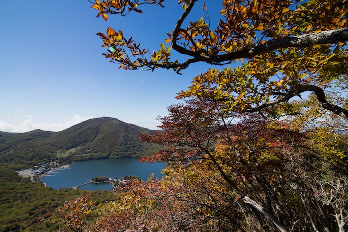
There are views of Lake Konuma from the right side of the trail. On a clear day, you can even see Mt. Fuji poking up through the clouds!
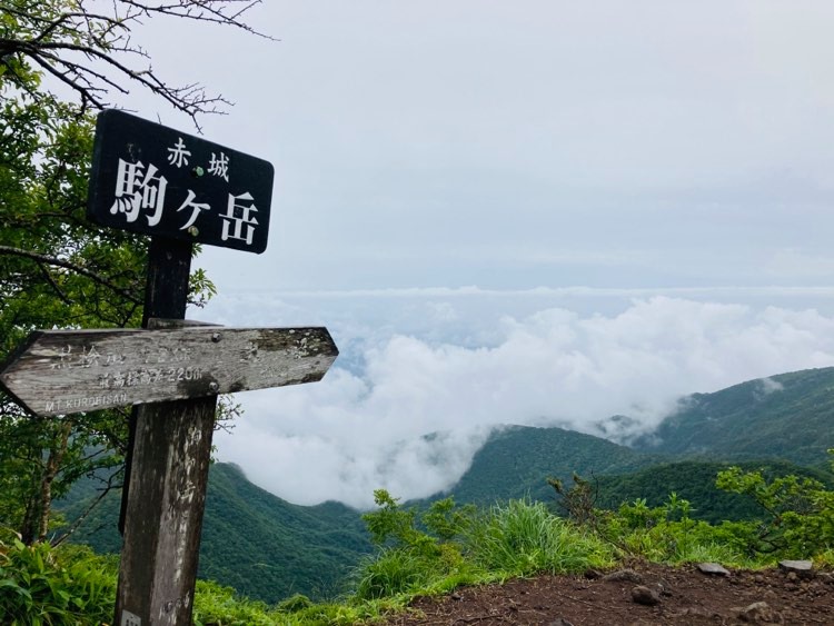
4. Mt. Komagatake https://goo.gl/maps/ynEppe2pii5r4u2N8
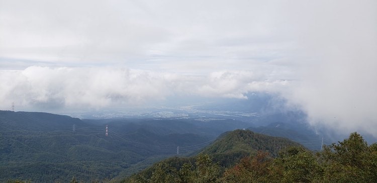
Here’s the Mt. Komagatake peak, with views of Tochigi, or maybe just some cool clouds 😅
The trail continues along the ridgeline for a little while, then turns west into the forest. There are intermittent wooden and metal stairs. It takes about 50 minutes from the Komagatake peak down to the road.
5.Mt. Komagatake Trailhead https://goo.gl/maps/JZB6bVQdzKxt2fPJ8
When you reach the end of the trail, turn right and walk about 5 minutes along the road to get back to the parking lot.
There are a bunch of restaurants and boat rentals right next to the parking lot, so feel free to grab a bite to eat or relax here after your hike.
Happy trails!